
Hurricane Francine brings floods and power cuts to Louisiana
World News
 Hurricane Francine
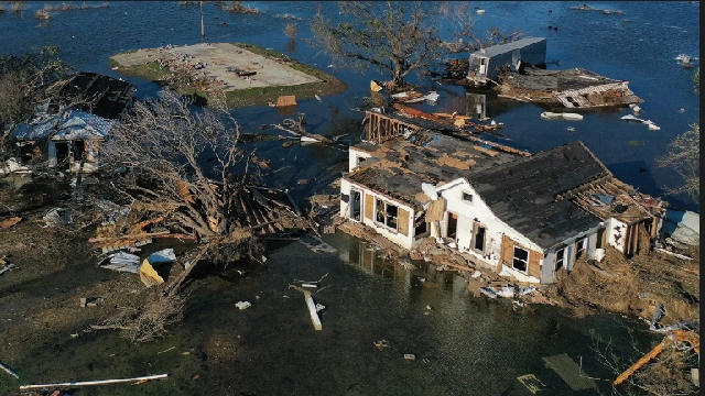
Hurricane Francine has left hundreds of thousands without power and caused widespread flooding after hitting the coast of Louisiana before driving inland.
It made landfall in Morgan City as a Category 2 storm at 17:00 local time (23:00GMT) on Wednesday, carrying winds of 100 mph (155 km/h), the National Hurricane Center (NHC) said.
A flash flooding emergency was issued for New Orleans after between six and eight inches (15-20cm) of rain fell.
Francine has been downgraded to a tropical storm but retained winds of up to 70mph as it passed north west of New Orleans, the NHC said late on Wednesday.
Both Louisiana and neighbouring Mississippi declared states of emergency and told residents to take shelter and brace for the major storm.
Governor Jeff Landry said at a press briefing on Wednesday residents should "stay off the roads, stay home and stay put".
Francine is expected to continue to "rapidly" lose strength as it travels across the state, forecasters say.
It was expected to bring 4-8 inches (10-20cm) of rainfall, potential tornadoes and damaging winds to much of central and eastern Louisiana, forecasters said.
More than 330,000 homes and businesses in Louisiana had lost power as of Wednesday night, according to Poweroutages.us.
A new tornado watch has issued for parts of southeastern Louisiana, southern Mississippi, southwestern Alabama, the Florida Panhandle until 06:00 local time on Thursday (12:00 BST).
Officials in Jefferson Parish, part of Greater New Orleans, urged residents to stay home due to "severe street flooding" late on Wednesday.
Meanwhile the Morgan City Police Department said the city was experiencing "unusual amounts of flooding" and asked people not to drive on flooded streets.
Residents in eastern Louisiana, Mississippi, southern Alabama and western Florida had been warned of a life-threatening storm surge.
A storm surge means there is a danger of water rising from the coastline and moving inland. In some places, water may rise up to 10ft (3m).
All flights in and out of New Orleans airport were cancelled for Wednesday.
Several of the state's coastal parishes are under voluntary or mandatory evacuation orders. Some schools and colleges have closed.
US oil and gas companies on the Gulf of Mexico, including Exxon Mobil and Shell, evacuated staff and paused some operations.
Jefferson Parish, which neighbours New Orleans, asked residents to conserve water to prevent the sewer system backing up into homes.
New Orleans reported that some mobile phone customers had been unable to call 911. Anyone in an emergency has been asked to call a backup police hotline.
Louisiana recently marked the 19th anniversary of Hurricane Katrina, which killed more than 1,800 people and caused widespread devastation.
The state mobilised resources and deployed water rescue teams before Francine arrived, the governor said, and was prepared to call on the National Guard for support if needed.
Francine’s development follows a quiet August and early September during the Atlantic hurricane season, which typically lasts until November. Experts earlier this summer had predicted a busier season.
Sarah Keith-Lucas, a weather presenter with the BBC, said the hurricane followed "a very quiet spell of weather in the Atlantic basin".
"The previous named storm in the region was Ernesto, back on 12 August," she said.
"The last time we had no named storms during this same period was back in 1968. Usually, this time of the year is peak hurricane season. Last year nine named storms formed between 13 August and 8 September."
Francine is the sixth named storm of 2024.
Hurricanes are categorised on a scale of one to five. Category five storms are the most destructive, with winds in excess of 157mph (250km/h).
There were 19 named storms in last year's hurricane season.
Source: BBC


Trending World

BBC complains to Apple over misleading shooting headline
04:58
West Africa bloc meets as military rulers vow to quit
16:09
2024 African elections: Some ruling parties retain power, some suffer defeats
14:54
Human Rights Watch accuses Sudan’s RSF of rape, sexual slavery
04:06
Nigeria investigates nearly 800 suspects arrested in massive cybercrime raid
03:08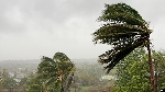
Storm Chido kills at least 7, leaves trail of damage in Malawi
03:05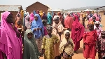
More than 2 million Nigerians kidnapped in one year, survey finds
05:32
China counting on cyber-psychological cocktail to expand dominance
11:33
Mogadishu development project brings hope to Somalia
11:41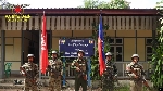
Myanmar ethnic rebels say they’ve captured junta western command
11:37